
Bug with Bing Maps for defined USA counties
Hello together,
I would like to visualize a kind of heatmap for the unemployment rate of all US states and counties.
Source for US Unemployment Rate States: https://www.bls.gov/web/laus/laumstrk.htm
Source for US Unemployment Rate Counties (just the latest): https://www.bls.gov/web/metro/laucntycur14.txt
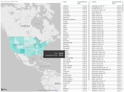
With the states everything is fine, like this: (data category = "state or province")
But with the counties it looks like this: (data category = "county", all counties named like "Anderson County, SC"
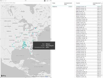
I've already tried to describe the county rows like this: "<County>, County, <State Code>", but there's no other result.
Could help me someone or is this a Bug with Bing/Microsoft?
Thank you very much!
BG,
Sven
4 Comments
 v-jiascu-msft
Microsoft Employee
Hi Sven,
Did you try using the Category Place?
Best Regards,
Dale
 Vicky_Song
Impactful Individual
Status changed:NewtoNeeds Info- AnonymousNot applicable
Hi v-jiascu-msft (Dale),
thank you for your idea, but this I've already tried as well.
At this time there's another problem with some counties.
If I set the data category to "place" Bing visualize some counties as the whole state and not only the small county...
Maybe do you have some other ideas?
BG,
SvenVicky_Song Thanks for switching the status! :)
- AnonymousNot applicable
Hi together,
I guess there are no other ideas?
BG,
Sven